














 Wetlands
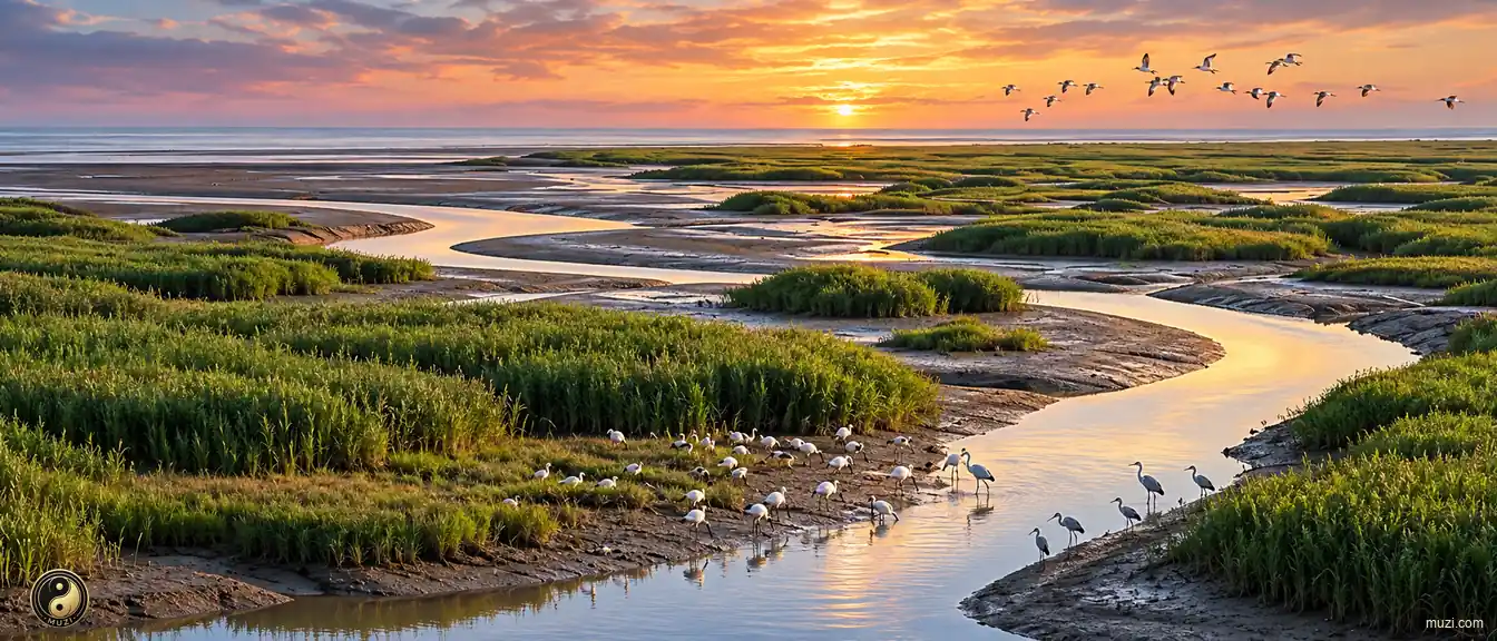
Yangtze Estuary Wetlands
Where Yangtze sediment meets the sea, accumulating into tidal flats — the core refueling station on the East Asian-Australasian Flyway for millions of migratory birds.
 MUZIChinese Matrix
Wetlands hold water between land and aquatic worlds, supporting migratory routes, nurseries, flood storage, and rich habitats.

Mountain ranges and massifs define the relief, climate, habitats, and horizons of an expansive landscape.

Basins gather mountains, rivers, settlements, and routes within a shared geographic bowl.

Plains open broad, level ground where rivers, soils, settlements, and cultivation can extend across wide horizons.

Plateaus rise as broad elevated lands, joining distinctive climates, grasslands, watersheds, and highland ways of life.

Rivers trace the land’s living arteries, linking headwaters, valleys, floodplains, and the communities shaped by flowing water.

Lakes gather water into enduring basins, shaping shorelines, wetlands, local climates, and the life around their shores.

Gorges compress rivers, cliffs, habitats, and routes into dramatic corridors carved through resistant terrain.

Deserts are arid landscapes where wind, stone, sand, sparse water, and resilient life define the regional character.

Forests weave trees, soils, water, wildlife, and layered habitats into a living ecological landscape.

Grasslands stretch across open country, where seasonal water, grazing, wind, and wildlife shape a mobile living landscape.

Wetlands hold water between land and aquatic worlds, supporting migratory routes, nurseries, flood storage, and rich habitats.

Saltwater forests where tidal roots shelter the living edge of land and sea.

Danxia terrain links red sandstone relief with forests, streams, and living mountain habitats.

Mountain passes turn difficult relief into traversable gateways, guiding movement, exchange, and the history of connected regions.

Civil works reshape terrain through canals, walls, roads, irrigation, and other engineered systems that organize movement and water.

Bridges link separated shores and landscapes, becoming infrastructure systems that carry movement, exchange, and shared regional life.

Regional corridors connect diverse terrains and communities through routes of movement, exchange, and shared geographic identity.

Harbors are sheltered waters where coastlines, shipping routes, working waterfronts, and urban exchange meet.

Islands are landforms set apart by water, carrying distinctive coastlines, ecosystems, settlements, and connections across the sea.

Coastal regions bring land, sea, estuaries, islands, and shore-based communities into one connected geographic system.

Historic cities preserve urban fabrics where streets, buildings, memories, and living communities carry accumulated history.

Historical villages and towns retain vernacular streets, local lifeways, and built landscapes shaped through generations.

Historic sites anchor a place in tangible remains, archaeological traces, and memories of events or communities.

Imperial tombs combine funerary landscapes, ceremonial architecture, burial grounds, and dynastic memory at territorial scale.

Temples are living sacred complexes where worship, architecture, landscape, and community traditions meet.

Grottoes unite carved stone spaces, sacred images, geology, and artistic traditions within a monumental cultural landscape.

Churches are active sacred buildings and complexes where worship, architecture, community life, and local history remain intertwined.

Ceremonial sites give collective rites a physical setting, joining sacred practice, public memory, and designed space.
Wetlands
Where Yangtze sediment meets the sea, accumulating into tidal flats — the core refueling station on the East Asian-Australasian Flyway for millions of migratory birds.
No Matrix entries match this region.