





 County-level
Ku Er Lei City
The strategic mountain defile of Iron Gate Pass guards ancient Silk Road routes in Korla, famed for sweet juicy fragrant pears on the Peacock River.
 MUZIChinese Matrix
In Bayingolin Mongol Autonomous Prefecture, wetland habitats and waterside routines reveal a deeper local trajectory.
Within the regional setting of Xinjiang, the spatial identity of Bayingolin is first captured by this local fact: “Wetland habitats and waterside routines reveal a deeper local trajectory.” It points to an observable local combination in which the setting of Bayingolin is shaped by both environment and lived practice. Historical development brought natural conditions and human activity into repeated negotiation, leaving traces in settlement, routes, and memory. Specific places and continuing lives turn a broad regional relationship into experience that can be observed and checked. The meaning of Bayingolin rests in specific places and continuing life, not only in its name or formal classification.
County-level
The strategic mountain defile of Iron Gate Pass guards ancient Silk Road routes in Korla, famed for sweet juicy fragrant pears on the Peacock River.
County-level
Over 400,000 mu of primeval desert poplars forest line the Tarim River in Luntai, site of the ancient Han-dynasty Western Regions Protectorate.
County-level
Lop Nur Village preserves ancient desert canoe fishing traditions in Yuli, where the meandering Tarim River meets the shifting sands of Taklamakan.
County-level
The enigmatic ruins of ancient Loulan Kingdom lie in the Lop Nur salt flats of Ruoqiang, near wild Tibetan antelopes in Altun Mountains.
County-level
Ancient Kunlun Mountain jade veins yield pristine mutton-fat nephrite in Qiemo, home to the millennia-old mummies of Zhagunluke ancient tombs.
County-level
The ancient cliff grottoes of Seven Stars and ruins of Karasahr Kingdom line the Kaidu River in Yanqi, celebrated for boutique basin vineyards.
County-level
World Heritage Bayanbulak Grassland shelters thousands of wild swans in Hejing, famed for the nine sun reflections winding along Kaidu River curves.
County-level
Golden sandy beaches of Jinshatan meet inland waves along Lake Bosten in Heshuo, backed by the flame-red Danxia bluffs of Mount Hongshan.
County-level
Vast reed beds and water-lily lagoons spread across Lake Bosten in Bohu, celebrated for freshwater fisheries and fresh lake fish banquets.
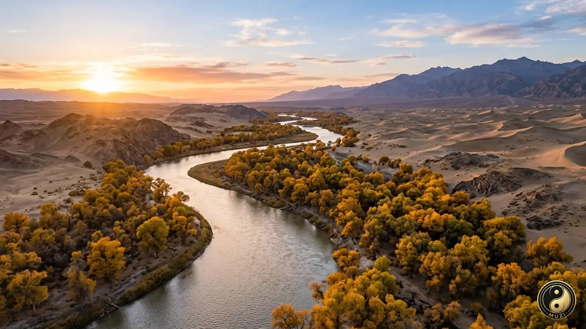
A hidden river flowing silently beneath the Taklamakan Desert — fed by Tianshan snowmelt, the underground lifeline sustaining desert oases.
The world's largest primeval desert poplar forest lining the banks of the Tarim River.
View attraction
An ancient indigenous desert settlement living alongside the Tarim River on traditional river fishing.
View attraction
A vital desert oasis reservoir channeling river runoff to nourish thousands of hectares of fertile farmland.
View attraction
The pioneer steel-concrete highway bridge spanning the river to unlock trans-Taklamakan desert trade.
View attraction