


 Inner Mongolia









 Wuhai
County-level
Hai Bo Wan District
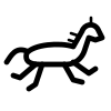
Prehistoric sun-god petroglyphs at Mount Zhuozi overlook the shimmering waters of Wuhai Lake, where desert dunes meet the Yellow River in Haibowan.
 MUZIChinese Matrix
 Wuhai
The Yellow River runs through Wuhai, where Wuhai Lake mirrors Mount Ganderl and the city is known as China's Calligraphy City.
For Wuhai, the relationship between place and life becomes visible in “The Yellow River runs through Wuhai, where Wuhai Lake mirrors Mount Ganderl and the city is known as China's Calligraphy City.” This evidence connects landform, movement, settlement, and cultural expression instead of treating them as isolated details. The present profile of Wuhai reflects environmental adaptation and local stewardship built up over an extended period rather than a short-lived change. This process explains how Wuhai remains connected to its surrounding region while retaining a recognizable local character. That is why Wuhai matters: local detail can illuminate environmental setting, social process, and cultural memory together.
Wuhai
County-level
Prehistoric sun-god petroglyphs at Mount Zhuozi overlook the shimmering waters of Wuhai Lake, where desert dunes meet the Yellow River in Haibowan.
 Wuhai
County-level
The Yellow River carves fertile oasis floodplains beneath the crags of Qianfoge canyon along the western rim of the Ordos Plateau in Hainan.
 Wuhai
County-level
Permian fossilized flora at the Wuda fossil beds reveal an ancient plant sanctuary, bordered by the tranquil waters of Ulannoor wetland.