


 Inner Mongolia









 Hulunbuir
County-level
Hai La Er District
The Hailar and Yimin rivers merge in Hailar, home to historic Qing-era fortress yamens and the resilient Scots pine forests of Mount Xishan.
 MUZIChinese Matrix
 Hulunbuir
 spans vast grasslands, the Ergun wetlands, the Manzhouli border port and the forests of the Greater Khingan Range.
 Hulunbuir
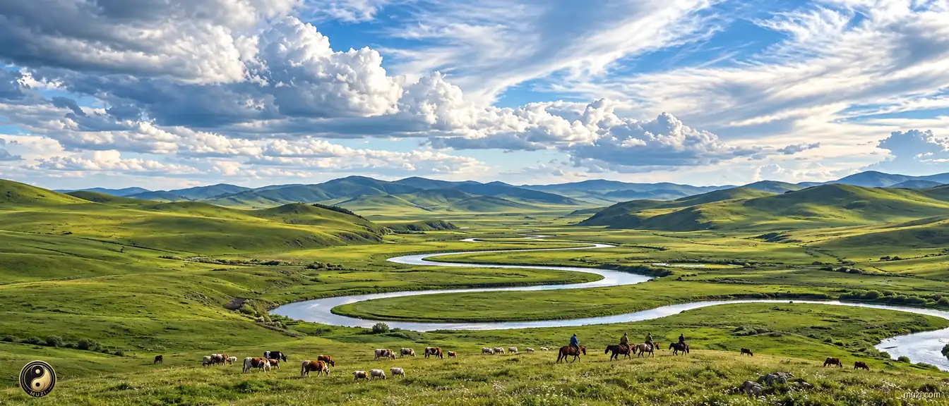
Riders guide grazing livestock across Hulunbuir grassland beside broad river bends beneath expansive clouds.
Open the entryIn regional terms, the clearest first clue to Hulunbuir is “Hulunbuir spans vast grasslands, the Ergun wetlands, the Manzhouli border port and the forests of the Greater Khingan Range.” Together, environmental, historical, and cultural elements give Hulunbuir a profile that can be distinguished from nearby places. Continuing local life gave inherited spaces new uses and memories, allowing historical layers and contemporary activity to coexist. Today, the interaction between environment and society remains visible in landscape, urban texture, daily activity, and local memory. These details make Hulunbuir a clear case of how a wider region is built from specific places and sustained lives.
Hulunbuir
County-level
The Hailar and Yimin rivers merge in Hailar, home to historic Qing-era fortress yamens and the resilient Scots pine forests of Mount Xishan.
 Hulunbuir
County-level
Paleolithic mammoth fossils excavated at Jalainur highlight ancient glacial ecology along the sparkling northern shores of Lake Hulun.
 Hulunbuir
County-level
The Arun River irrigates rich black-soil grain lands on the eastern slopes of the Greater Khingan range in Arun Banner.
 Hulunbuir
County-level
Indigenous Daur traditions flourish along the western banks of the Nenjiang River in Morin Dawa, celebrated as the historic home of field hockey.
 Hulunbuir
County-level
Ancient rock inscriptions inside Gaxian Cave mark the ancestral home of the Tuoba Xianbei rulers among the dense taiga forests of Oroqen.
 Hulunbuir
County-level
Virgin Scots pine forests of Honghuaerji border the rich crane habitats of the Huihe wetland across the rolling steppes of Ewenki.
 Hulunbuir
County-level
The winding loops of the Morigele River serpentine through the emerald heart of the Hulunbuir Grassland in Old Barag Banner.
 Hulunbuir
County-level
The golden domes of Ganzhuer Temple glisten across the vast steppes of New Barag Left Banner, beside the serene waters of Lake Nuogan.
 Hulunbuir
County-level
Vast shimmering waters of Lake Hulun and Lake Buir anchor the boundless pastures of New Barag Right Banner, rich in traditional equestrian life.
 Hulunbuir
County-level
The imposing border gateway and customs port anchor Manzhouli, for vibrant Russian architectural heritage and Matryoshka plazas.
 Hulunbuir
County-level
Endless larch and birch woodlands blanket the slopes of the Greater Khingan range in Yakeshi, renowned for pristine winter snowfields at Phoenix Mountain.
 Hulunbuir
County-level
Historic timber suspension bridges cross the Yalu River in Zalantun, famed for Russian architectural heritage along historic avenues.
 Hulunbuir
County-level
Meandering wetlands of the Ergun River surround Shiwei, the historic forest cradle of the Mongolic tribes, dotted with traditional Russian log cabins.
 Hulunbuir
County-level
The indigenous Aoluguya Ewenki herd reindeer through subarctic taiga forests in Genhe, renowned as the extreme northern cold pole among pine woodlands.
 Hulunbuir
's broad natural grasslands supported pastoral life and supplied horses and livestock beyond the Great Wall.
Praised by the writer Lao She as the most winding river under heaven, the Morgle meanders like a silver ribbon across the vast Hulunbuir grassland.
View attraction
Paired in a popular saying with Xishuangbanna in the south, Mo'erdaoga protects a vast primeval larch forest at the ecological heart of the Greater Khingan.
View attraction